Ha Long Bay map: where the bay is and what is where
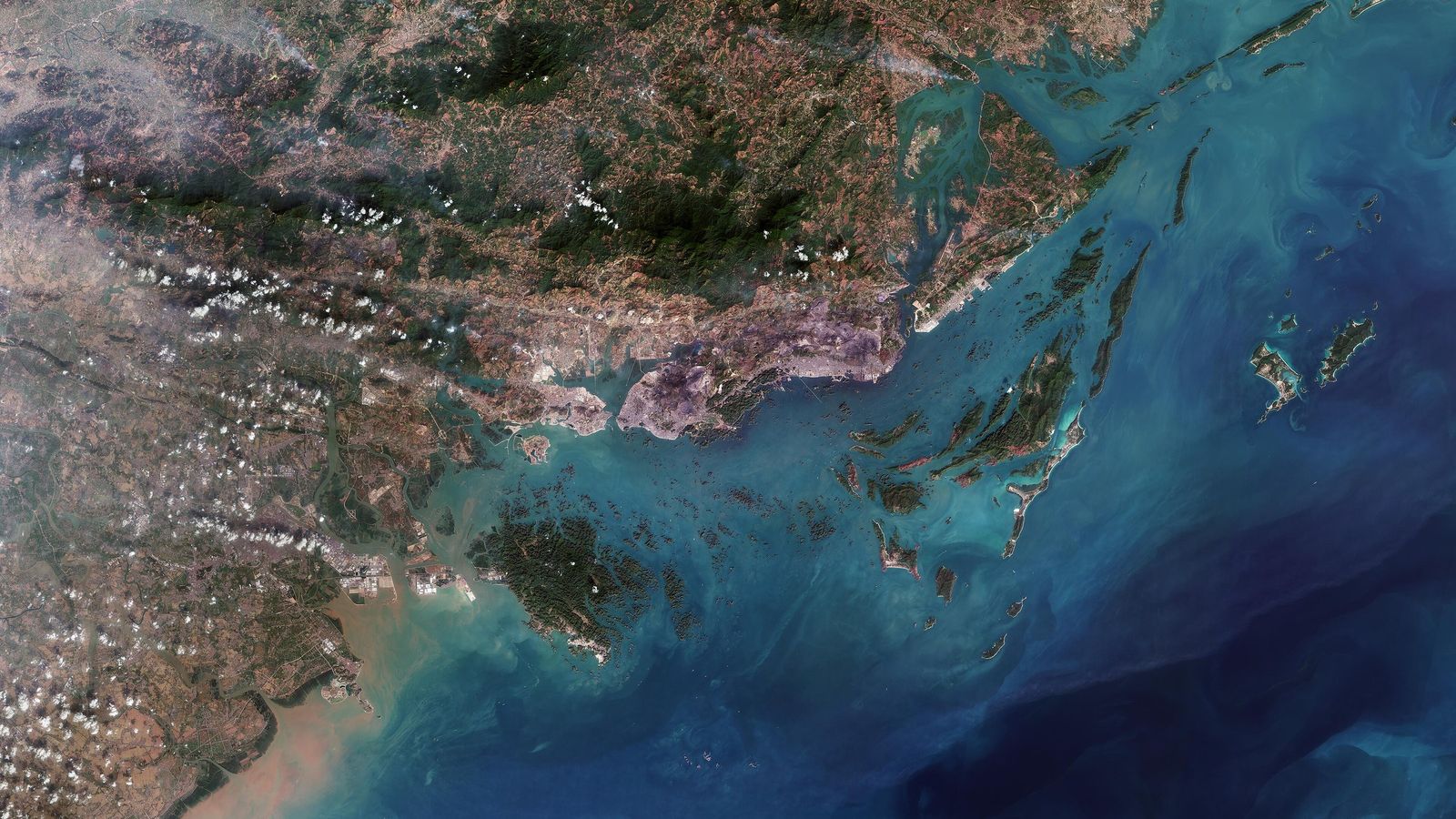
Ha Long Bay is in Quảng Ninh in north-east Vietnam, on the Gulf of Tonkin, about 165 km east of Hanoi. Boats leave from Tuần Châu and the Bãi Cháy waterfront.
Interactive Google Map
The Google Map opens on a satellite view of Ha Long Bay centred on 20.9100512, 107.1839024. It loads only when you press the button.
Ha Long Bay lies off the north-east coast of Vietnam. The map opens in the middle of the bay, east of the Hạ Long waterfront where the boats leave, with Cát Bà Island to the south-west and Bái Tử Long Bay to the north-east.
The pin is this guide’s chosen point for the bay and not an official coordinate. UNESCO’s reference point for the World Heritage property lies about 9 km to the south-south-west.
Drawn map behind the button: map data © OpenStreetMap contributors. Its red lines join each route’s stops in order and are schematic.
Where is Ha Long Bay?
Ha Long Bay is in Quảng Ninh in north-east Vietnam, on the Gulf of Tonkin, about 165 km east of Hanoi by the management board’s figure and about 60 km east of Hải Phòng. The Chinese border crossing at Móng Cái is about 3.5 hours away by road.
Map of the caves, islands and ports
The drawn map marks 43 places: four ports and piers, an airport, four towns and districts, three bays, nine islands, four islets, ten caves, four villages, two parks, a museum and a bridge. Each has its Vietnamese and English name and, where it has one, the Board’s route code, and the same list follows in text below the maps.


What the symbols mark
- Port or pier
- Airport
- Town or ward
- Island
- Islet
- Cave
- Fishing village
- Park, museum or bridge
The Board's routes
- VHL1 Thiên Cung and Đầu Gỗ caves, Đỉnh Hương and Trống Mái islets
- VHL2 Ti Tốp Island and the caves of Bồ Hòn island
- VHL3 Cửa Vạn and Tiên Ông cave
- VHL4 Hang Cỏ, Hang Thầy, Vung Viêng, Cống Đỏ and Hòn Xếp
- VHL5 The VHL1 stops, then one way to Gia Luận on Cát Bà
- VHL6 To Hòn Cặp Bài, for boats licensed between Hạ Long and Cát Bà
- VHL8 Along the shore past the Bãi Cháy Bridge, for dinner boats
Eighteen of the 43 positions mark the feature itself, such as a cave entrance or a pier, to within about 100 m. The other 25 are the centre of an island, bay or town, a village anchorage, or for Hòn Xếp and Hòn Cặp Bài an estimate from the Board’s distances to the two ports. VHL7, which combines VHL1 to VHL4 in one day for fast explorer yachts, has no line of its own.
Sixteen stops on the Board’s routes have no reliable position, so they are not drawn: Hang Trống, Hang Hồ Động Tiên, Hang Ba Hang, Hồ Ba Hầm, Hòn Chó Đá, Hòn Muối Nam, Động Cặp La, Vụng Tùng Sâu, Khu sinh thái Tùng Áng, Đền Bà Men, Áng Dù, Rừng Trúc, Hòn Chân Voi, Vụng Ba Cửa, Đảo Tùng Lâm and Cảng Nam Cầu Trắng. A place on a route is not always open: Soi Sim has been closed since 2020, the Cửa Vạn cultural centre since 25 April 2024, and Rừng Trúc is not yet open.
Ports, piers and airport
- Cảng tàu khách quốc tế Tuần Châu Tuan Chau International Passenger Port Read more: Cruises and day trips
- Cảng tàu khách quốc tế Hạ Long Ha Long International Passenger Port Read more: Cruises and day trips
- Bến Gia Luận (bến phà Gia Luận) Gia Luan Pier (Cat Ba) Read more: Cat Ba Island
- Cảng Ao Tiên Ao Tien Port (Van Don) Read more: Bai Tu Long Bay
- Sân bay quốc tế Vân Đồn Van Don International Airport Read more: Hanoi to Ha Long Bay
Towns and wards
- Bãi Cháy Bai Chay Read more: Where to stay, fees and days
- Hồng Gai (Hòn Gai) Hong Gai (Hon Gai) Read more: Where to stay, fees and days
- Thị trấn Cát Bà Cat Ba town Read more: Cat Ba Island
- Cẩm Phả Cam Pha Read more: Bai Tu Long Bay
Bays
- Vịnh Hạ Long Ha Long Bay Read more: Ha Long Bay, Vietnam
- Vịnh Lan Hạ Lan Ha Bay Read more: Lan Ha Bay
- Vịnh Bái Tử Long Bai Tu Long Bay Read more: Bai Tu Long Bay
Islands
- Đảo Tuần Châu Tuan Chau Island (former island, now phường Tuần Châu) Read more: Islands and islets
- Đảo Cát Bà Cat Ba Island Read more: Cat Ba Island
- Đảo Ti Tốp Ti Top Island (Titop, Titov Island) Read more: Islands and islets
- Đảo Soi Sim Soi Sim Island Read more: Islands and islets
- Đảo Bồ Hòn Bo Hon Island Read more: Islands and islets
- Đảo Đầu Gỗ Dau Go Island Read more: Islands and islets
- Đảo Cống Đỏ Cong Do Island Read more: Islands and islets
- Đảo Quan Lạn Quan Lan Island Read more: Bai Tu Long Bay
- Đảo Ngọc Vừng Ngoc Vung Island Read more: Bai Tu Long Bay
Islets
- Hòn Trống Mái (Hòn Gà Chọi) Trong Mai Islet (Cock and Hen Islet, Fighting Cocks, "Kissing Rocks") Read more: Islands and islets
- Hòn Đỉnh Hương (Hòn Lư Hương) Dinh Huong Islet (Incense Burner Islet) Read more: Islands and islets
- Hòn Xếp Hon Xep (Stacked-Rock Islet) Read more: Islands and islets
- Hòn Cặp Bài Cap Bai Islet (Playing-Cards Islet) Read more: Islands and islets
Caves
- Động Thiên Cung Thien Cung Cave (Heavenly Palace Grotto) Read more: Caves
- Hang Đầu Gỗ Dau Go Cave (Wooden Stakes Cave) Read more: Caves
- Hang Sửng Sốt Sung Sot Cave (Surprise Cave) Read more: Sung Sot Cave
- Động Mê Cung Me Cung Cave (Maze Cave) Read more: Caves
- Hang Luồn Luon Cave Read more: Caves
- Hang Bồ Nâu Bo Nau Cave (Pelican Cave) Read more: Caves
- Hang Trinh Nữ Trinh Nu Cave (Virgin Cave) Read more: Caves
- Hang Tiên Ông Tien Ong Cave (Old Sage Cave) Read more: Caves
- Hang Cỏ (Động Thiên Cảnh Sơn) Co Cave (Thien Canh Son Cave) Read more: Caves
- Hang Thầy Thay Cave Read more: Caves
Fishing villages
- Làng chài Cửa Vạn Cua Van fishing village (floating village) Read more: Floating villages
- Làng chài Vung Viêng (Vông Viêng) Vung Vieng fishing village Read more: Floating villages
- Làng chài Cái Bèo Cai Beo floating village (Cat Ba) Read more: Lan Ha Bay
- Làng Việt Hải Viet Hai village (Cat Ba National Park) Read more: Cat Ba Island
Parks, museum and bridge
- Vườn quốc gia Cát Bà Cat Ba National Park Read more: Cat Ba Island
- Sun World Hạ Long (cáp treo Nữ Hoàng) Sun World Ha Long (Queen Cable Car) Read more: Things to do
- Bảo tàng Quảng Ninh Quang Ninh Museum Read more: Things to do
- Cầu Bãi Cháy Bai Chay Bridge Read more: Things to do
What each cave is like, and which to choose, is on the caves page; the islands where boats land, and the rocks seen from the deck, are on the islands page.
The closest city to Ha Long Bay
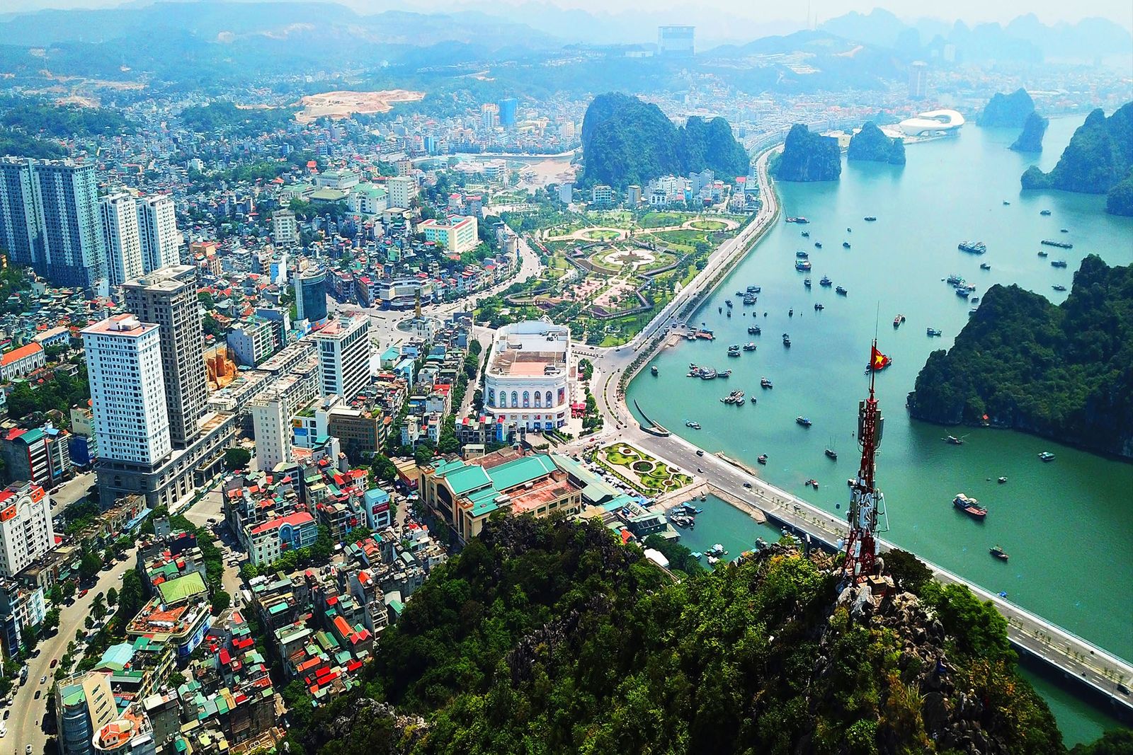
The bay lies beside the Bãi Cháy and Hồng Gai waterfronts of what was Hạ Long city, now wards of Quảng Ninh, which became a city itself on 1 September 2026. The next city to the west is Hải Phòng, about 60 km away.
The old city falls into two halves on either side of the Bãi Cháy Bridge. Bãi Cháy, on the west side, holds most of the hotels, restaurants and tourist sites, the beach and the Hạ Long passenger port; the ward received about 8.3 million visitor arrivals in 2025. Hòn Gai, east of the bridge and now spelt Hồng Gai, is the older, working side, with the cargo port, the Hạ Long market, the Quảng Ninh Museum and Bài Thơ mountain.
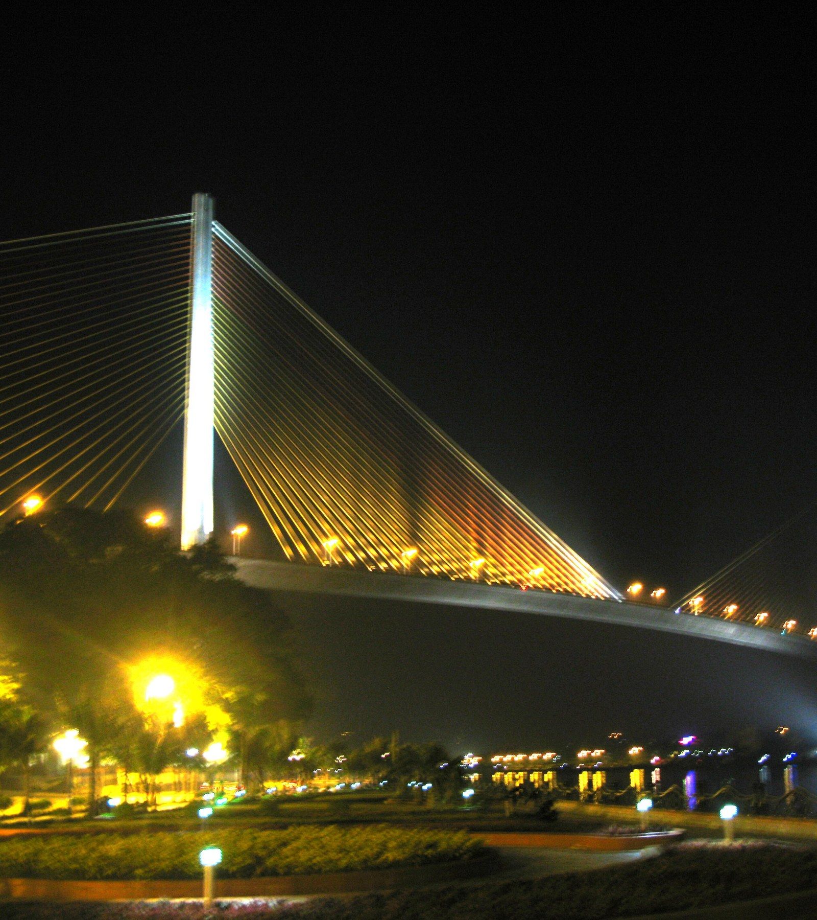
The bridge itself, 903 m long with a main span of 435 m, opened on 2 December 2006 across the mouth of Cửa Lục Bay, a shallow inlet of about 18 km² with mangroves and tidal flats. Tuần Châu, a former island joined to the mainland by a road, has the marina and the other passenger port, 13.7 km by road from Bãi Cháy’s. Cẩm Phả lies further east; the Bái Tử Long routes BTL7 to BTL10 are listed to start there, though their launch has not been confirmed.
Distances at a glance
Hạ Long International Passenger Port is about 152 km by road from Hanoi’s Old Quarter, 47 km from Cát Bi airport, 53 km from Vân Đồn airport and 13.7 km from Tuần Châu port, and the best-known caves lie 3 to 14 km from Tuần Châu port by the Board’s figures.
| From | To | Km | How |
|---|---|---|---|
| Hanoi (the capital) | Ha Long Bay | 165 | Not stated (the Board gives an official round figure) |
| Hanoi Old Quarter (Hàng Ngang and Hàng Đào area) | Hạ Long International Passenger Port (Bãi Cháy) | 152 | Road, computed; 1 h 50 min at free-flow speed with no traffic and no stops |
| Hanoi Old Quarter (Hàng Ngang and Hàng Đào area) | Tuần Châu port | 147 | Road, computed; 1 h 44 min at free-flow speed |
| Hanoi Old Quarter (Hàng Ngang and Hàng Đào area) | Bãi Cháy long-distance bus station (Bến xe Bãi Cháy) | 150 | Road, computed; 1 h 42 min at free-flow speed |
| Nội Bài airport | Hạ Long International Passenger Port (Bãi Cháy) | 174 | Road via the Nhật Tân bridge and the ring road, computed; 2 h 10 min at free-flow speed |
| Nội Bài airport | Tuần Châu port | 169 | Road, computed; 2 h 05 min at free-flow speed |
| Nội Bài airport | Bãi Cháy long-distance bus station (Bến xe Bãi Cháy) | 171 | Road, computed; 2 h 03 min at free-flow speed |
| Mỹ Đình bus station (Hanoi) | Bãi Cháy long-distance bus station (Bến xe Bãi Cháy) | 161 | Road, computed |
| Tuần Châu port | Hạ Long International Passenger Port (Bãi Cháy) | 13.7 | Road, computed; 17 min |
| Bãi Cháy long-distance bus station (Bến xe Bãi Cháy) | Hạ Long International Passenger Port (Bãi Cháy) | 7.6 | Road, computed; 10 min |
| Bãi Cháy long-distance bus station (Bến xe Bãi Cháy) | Tuần Châu port | 9 | Road, computed; 12 min |
| Hải Phòng railway station | Hạ Long International Passenger Port (Bãi Cháy) | 48.7 | Road, computed; 43 min at free-flow speed; Hạ Long is about 60 km from Hải Phòng city centre |
| Vân Đồn International Airport | Hạ Long International Passenger Port (Bãi Cháy) | 53 | Hạ Long to Vân Đồn expressway, computed; 51 min at free-flow speed |
| Ninh Bình railway station | Hạ Long International Passenger Port (Bãi Cháy) | 170 | Non-expressway roads, computed, because the Ninh Bình to Hải Phòng expressway is under construction |
| Hạ Long International Passenger Port (Bãi Cháy) | Yên Tử (Giải Oan pagoda and lower cable-car stations) | 54 | Road, computed; 58 to 60 min at free-flow speed, slower at festival time |
| Hạ Long International Passenger Port (Bãi Cháy) | Quang Hanh hot springs (Cẩm Phả side) | 21 | Road, computed; 23 min |
| Place | From Tuần Châu port, km | From Hạ Long port, km |
|---|---|---|
| Hòn Đỉnh Hương (Incense Burner Islet) | 2.5 | 8.5 |
| Động Thiên Cung (Thien Cung Cave) | 3 | 6 |
| Hòn Trống Mái (Kissing Rocks) | 5 | 7 |
| Hòn Cặp Bài (Playing-Cards Islet) | 6 | 13 |
| Đảo Ti Tốp (Ti Top Island) | 12 | not given |
| Hang Luồn (Luon Cave) | 13 | 11 |
| Hang Sửng Sốt (Sung Sot Cave) | 14 | 11 |
| Động Mê Cung (Me Cung Cave) | 14 | not given |
| Hang Tiên Ông (Tien Ong Cave) | 18 | not given |
| Hang Cỏ (Co Cave) | 19 | 14 |
| Vung Viêng fishing village | 20 | 16 |
| Cửa Vạn fishing village | 20 | not given |
| Đảo Cống Đỏ (Cong Do Island) | 23 | 18 |
| Hang Thầy (Thay Cave) | 23 | not given |
| Hòn Xếp (Stacked-Rock Islet) | 30 | 25 |
The cruise routes on the map
The Board’s eight itineraries start at the two ports. VHL1 and VHL2 carry most day-trippers, VHL3 and VHL4 reach the south-east of the bay and are mainly done on overnight cruises, and VHL5 ends at Gia Luận on Cát Bà.
| Route | Drawn stops, in order | Stops not drawn | Notes |
|---|---|---|---|
| VHL1 | Động Thiên Cung, Hang Đầu Gỗ, Hòn Đỉnh Hương, Hòn Trống Mái | hòn Chó Đá, hang Ba Hang | Out and back from either port; Đỉnh Hương and Trống Mái are seen from the boat only. Adult fee 250,000 VND. |
| VHL2 | Đảo Soi Sim, Đảo Ti Tốp, Hang Sửng Sốt, Động Mê Cung, Hang Bồ Nâu, Hang Luồn, Hang Trinh Nữ | vụng Tùng Sâu, hang Trống, hồ (hang) Động Tiên | Soi Sim has been closed since 2020. Adult fee 250,000 VND. |
| VHL3 | Cửa Vạn, Hang Tiên Ông | hồ Ba Hầm, đền Bà Men, Áng Dù, Rừng Trúc (not yet open) | The Cửa Vạn Floating Cultural Centre has been closed to visits since 25 April 2024. Adult fee 200,000 VND. |
| VHL4 | Hang Cỏ, Hang Thầy, Vung Viêng, Đảo Cống Đỏ, Hòn Xếp | động Cặp La, khu sinh thái Tùng Áng | Adult fee 200,000 VND. Overnight anchorage at Cống Đỏ. |
| VHL5 | Động Thiên Cung, Hang Đầu Gỗ, Hòn Đỉnh Hương, Hòn Trống Mái, Bến Gia Luận | hòn Chó Đá, hang Ba Hang | The VHL1 stops, then a one-way crossing to Gia Luận on Cát Bà. Adult fee 250,000 VND. |
| VHL6 | Hòn Cặp Bài | hòn Chân Voi, vụng Ba Cửa, đảo Tùng Lâm | New from 1 May 2025; for vessels licensed to run between Hạ Long and Cát Bà. 150,000 VND per person per day. |
| VHL7 | none | none | VHL1 + VHL2 + VHL3 + VHL4 in one day, only for fast explorer yachts (du thuyền khám phá). 600,000 VND. |
| VHL8 | Cầu Bãi Cháy | cảng Nam Cầu Trắng | A coastal run past Bãi Cháy, the bridge and the city for restaurant and dinner boats. 70,000 VND. |
VHL3 and VHL4 averaged only 200 to 400 passengers a day in 2025, against the crowded VHL1 and VHL2. Boats, prices and what each route is like are on the cruises page.
Questions visitors ask
Which city is Halong Bay in?
Ha Long Bay lies off Quảng Ninh, a city since 1 September 2026. The bay faces the Bãi Cháy and Hồng Gai wards, which belonged to Hạ Long city until 1 July 2025; “Hạ Long” now survives as the name of the bay and of the ports.
What is the closest city to Halong Bay?
The bay faces the waterfront wards of Bãi Cháy and Hồng Gai, formerly Hạ Long city. Hải Phòng is the next city to the west, about 60 km away. Getting there from Hanoi.
Is Halong Bay closer to Hanoi or Ho Chi Minh City?
Hanoi. The bay is in north-east Vietnam, 165 km from the capital by the Board’s figure, and the drive usually takes 2.5 to 3.5 hours. Hanoi to Ha Long Bay.
How do I get there?
By road from Hanoi: shared limousine van, coach or private car, usually 2.5 to 3.5 hours (3 to 4 hours door to door). Cát Bi airport is about 47 km from the passenger port and Vân Đồn airport about 53 km. Every way there.
Where do the boats leave from?
From Tuần Châu International Passenger Port and from Hạ Long International Passenger Port on the Bãi Cháy waterfront, 13.7 km apart by road. Cruises and day trips.
Is Lan Ha Bay part of Ha Long Bay?
Lan Hạ Bay lies east of Cát Bà Island and south of Ha Long Bay, in Hải Phòng. It is a separate bay with its own boats and tickets, inside the same World Heritage property since 2023. Lan Ha Bay or Ha Long Bay?.
Sources
Facts checked- Ha Long Bay - Yen Tu World Heritage Management Board, Vị trí địa lý (location, area and island count), updated 6 November 2024.
- Ha Long Bay - Yen Tu World Heritage Management Board, Đường đến Hạ Long (getting to Hạ Long).
- Ha Long Bay - Yen Tu World Heritage Management Board, Hành trình VHL1 to VHL8 (itinerary pages) and place pages for each cave, island and village.
- Ha Long Bay - Yen Tu World Heritage Management Board, Giá trị Đa dạng sinh học (the bay and its neighbours), updated 2 November 2024.
- UNESCO World Heritage Centre, Ha Long Bay - Cat Ba Archipelago (list entry 672).
- UNESCO World Heritage Committee, Decision 45 COM 8B.3, 16 September 2023.
- IUCN, Technical evaluation 2022 (document 205800), 2022.
- OpenStreetMap contributors, Coastline and place data, read through the Overpass API and Nominatim, 3 October 2026.
- OpenStreetMap contributors, Road distances calculated with OSRM routing on OpenStreetMap data, 3 October 2026.
- Wikidata, Q190128 (Ha Long Bay) and Q10742189 (Bai Tu Long National Park).
- Google Maps, Place pin for Vịnh Hạ Long (20.9100512, 107.1839024).
- VnExpress, Việt Nam có thêm hai thành phố trực thuộc Trung ương, 24 August 2026.
- VnExpress, Kinh nghiệm du lịch Hạ Long 2026, updated 28 September 2026.
- VnExpress, Cầu Bãi Cháy sau hơn 10 năm vận hành, 22 November 2019.
- CafeF, Vịnh biển chỉ rộng 18 km2 nhưng có đến 6 cây cầu kết nối, 19 June 2024.
- Báo Quảng Ninh, Bãi Cháy trên hành trình trở thành phường du lịch thông minh, 14 December 2025.
- 12go, Hanoi to Halong Bay timetable, read 3 October 2026.
- Wikipedia, Hạ Long (city), Hải Phòng - Hạ Long - Vân Đồn - Móng Cái expressway, Van Don International Airport, read 3 October 2026.
Prices, fees and timetables change. Figures on this page were checked in the month shown on the postmark.