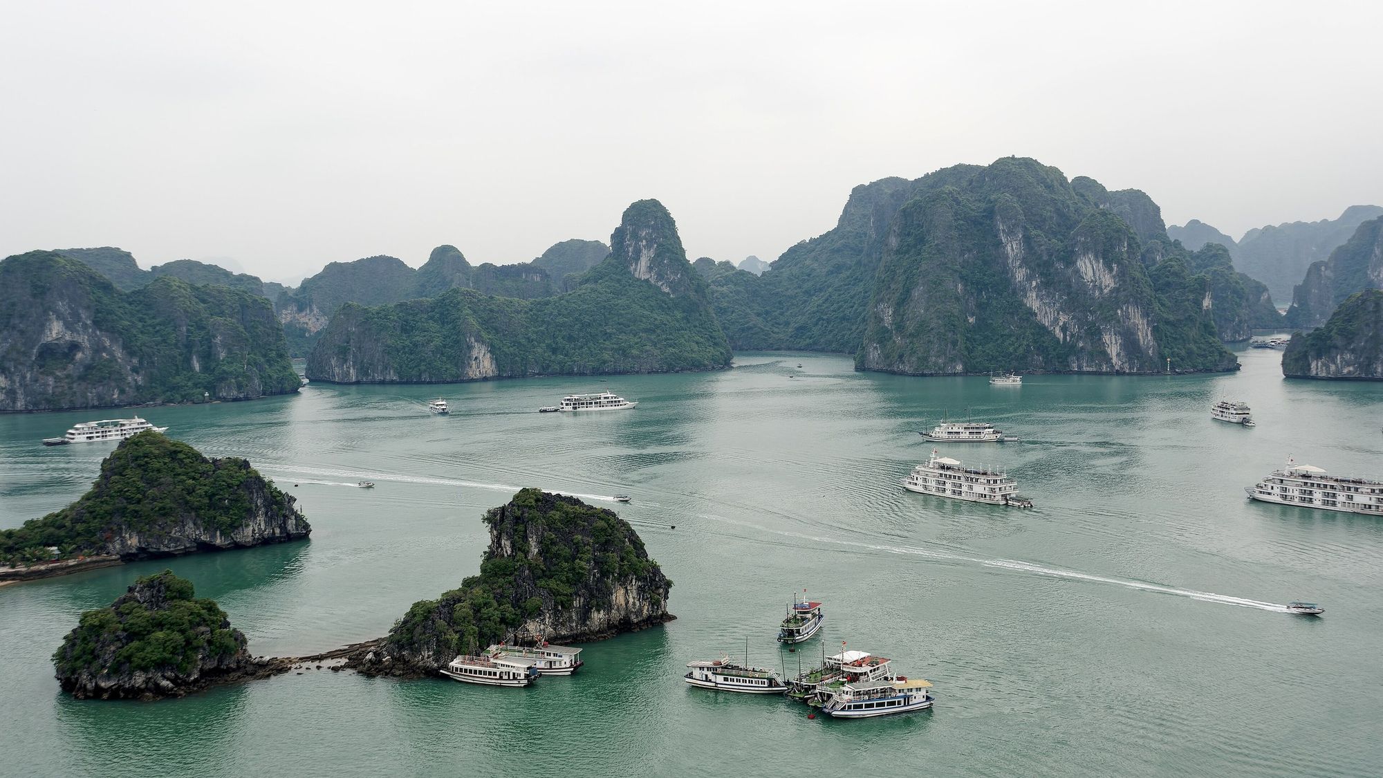
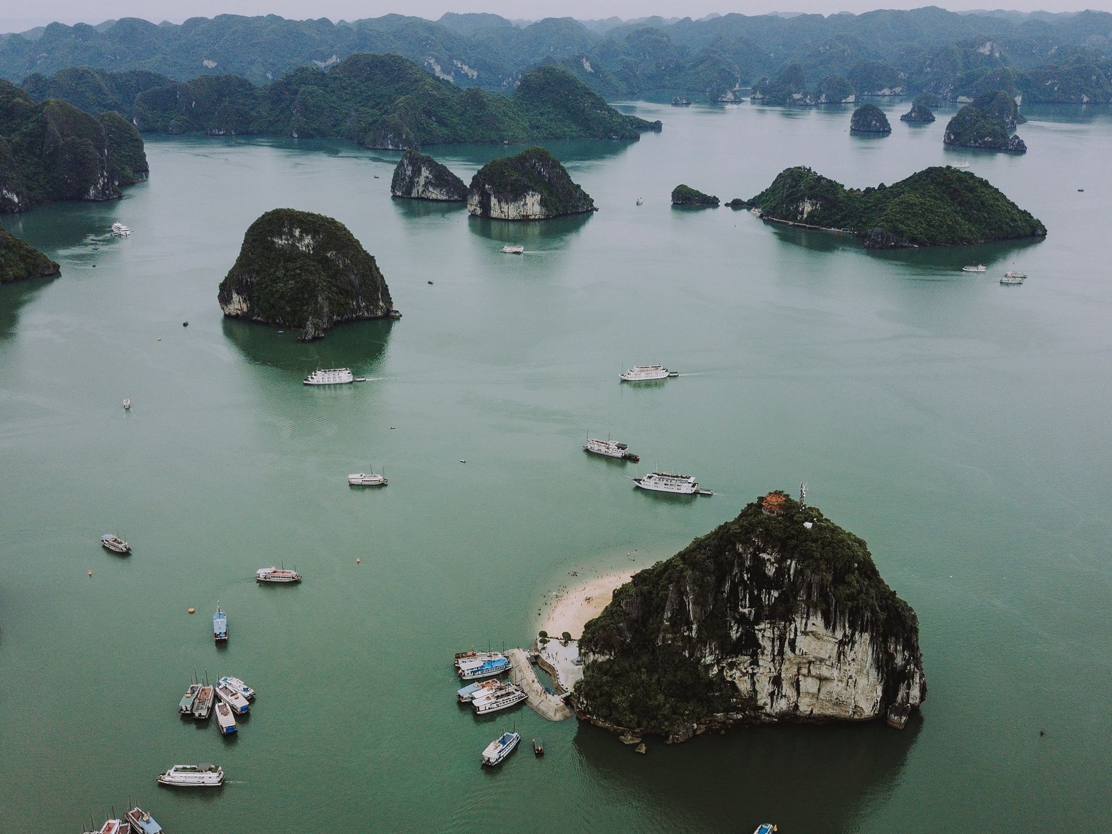
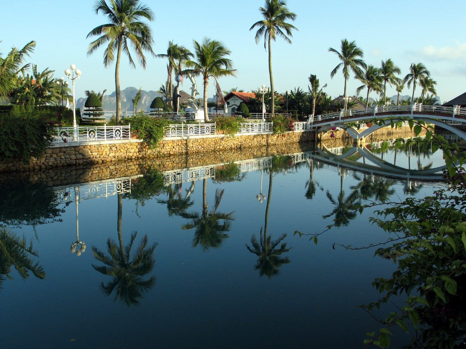
Đảo Ti TốpTwin islets joined by a narrow spit lie below the viewpoint on Ti Tốp Island, with tour boats on the water.Photo: Jakub Hałun, CC BY 4.0
How many islands are in Ha Long Bay?
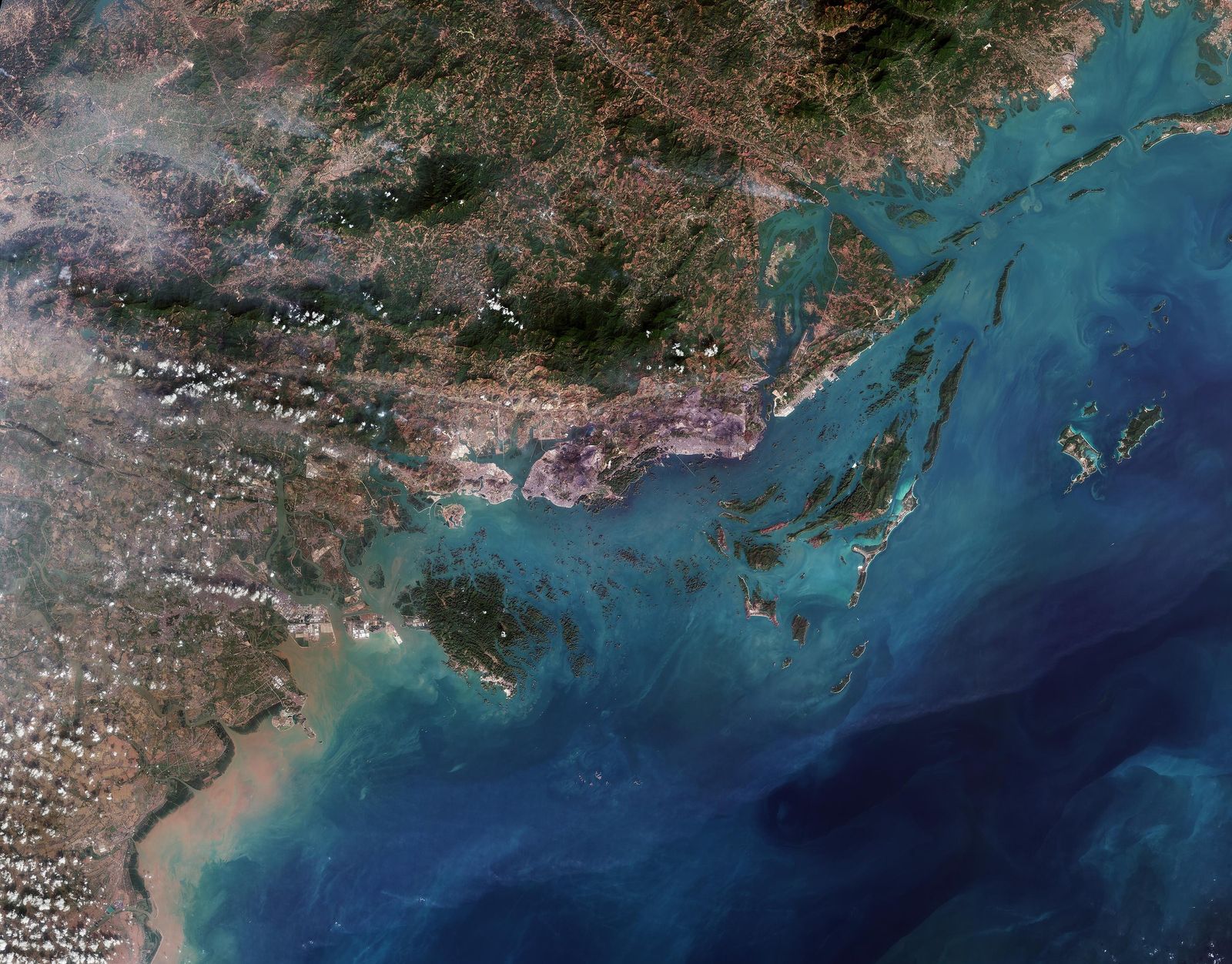
The bay’s management board, the Ha Long Bay - Yen Tu World Heritage Management Board, counts 1,969 islands and islets in Vịnh Hạ Long (Ha Long Bay), 980 of them with names, across 1,553 km². UNESCO counts the World Heritage property separately, and older texts use other rounded figures, so the numbers online vary. “About 2,000 islands” is a safe rounded figure for the bay.
1,969islands and islets (Board count)
980of them with names
1,553km², the area of the bay
Island counts by scope. The three official counts measure different areas, so they should never be mixed.
Scope
Islands and islets
Named
Area
Source
Ha Long Bay (the Board count)
1,969
980
1,553 km²
Board, Vị trí địa lý (updated 6 November 2024)
World Heritage core zone inscribed in 1994
775
411
434 km²
Board; IUCN technical evaluation 2000
World Heritage property since 16 September 2023: Ha Long Bay - Cat Ba Archipelago
1,133 (775 in Ha Long Bay, 358 in the Cát Bà archipelago)
Not published
656.5 km², with a buffer zone of 341.4 km²
UNESCO World Heritage Centre, list entry 672
Older UNESCO and IUCN wording, still in UNESCO's brief description
Some 1,600
Not given
Not given
IUCN technical evaluation 2000
Since 16 September 2023 the World Heritage property has been called Ha Long Bay - Cat Ba Archipelago. It covers 656.5 km² and holds 1,133 islands and islets, 775 of them in Ha Long Bay and 358 in the Cát Bà archipelago, so it is a different area from the one the Board counts. UNESCO’s brief description still says “some 1,600 islands and islets”, wording that dates from 1994 and 2000.
More than 90% of the islands are limestone, 50 to 200 m high, and the rest are earth islands covered in vegetation. The smaller ones are towers 50 to 100 m high, many with sheer walls on every side. The larger ones carry clusters of cone-shaped hills whose summits average about 100 m above the sea, and a few rise past 200 m. How the sea came to flood them is told on the history and geology page.
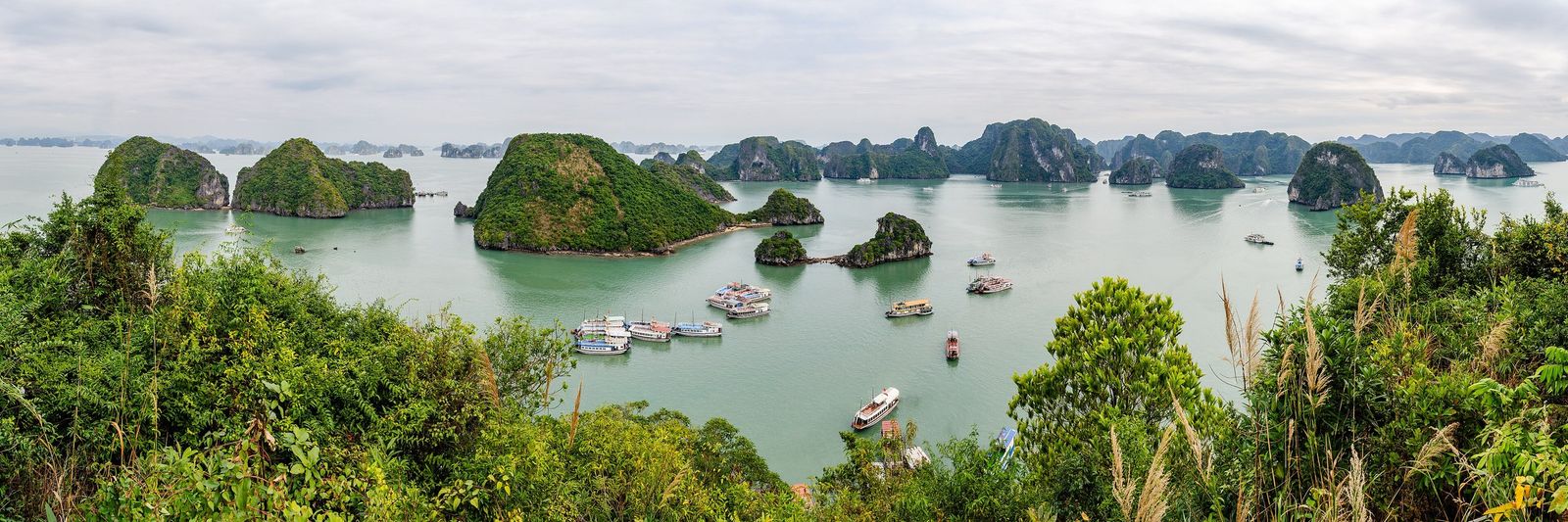
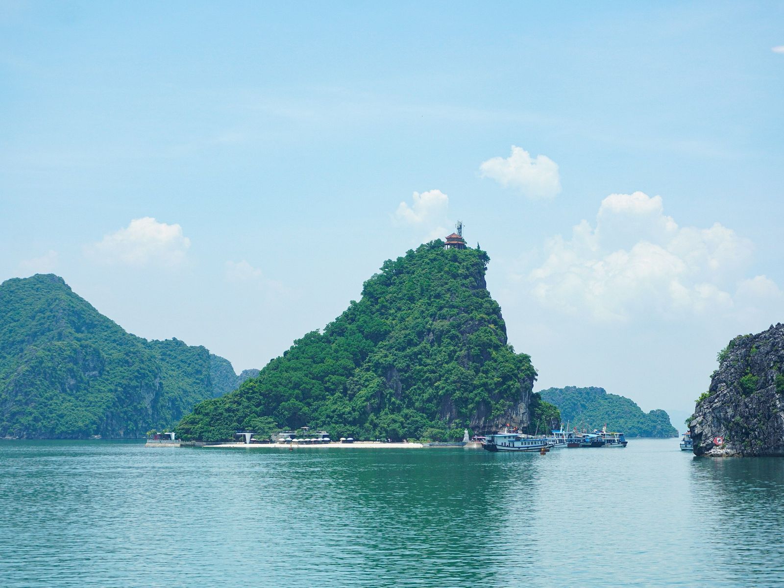
Đảo Ti Tốp (Ti Top Island) has a stairway of nearly 400 stone steps to a viewpoint pavilion about 100 m above the sea, and a crescent beach at its foot that was the only licensed swimming beach operating in the whole bay in 2023. It is a stop on route 2, about 12 km by boat from Tuần Châu port, facing Bồ Hòn island.
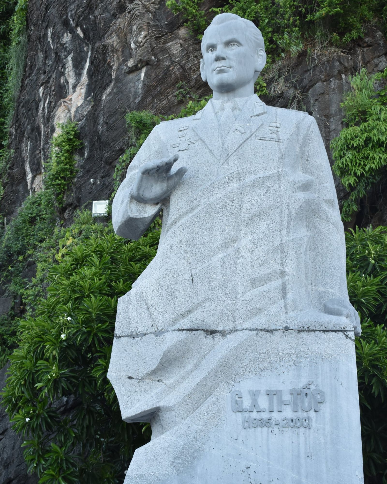
The island is named after a person. On 22 January 1962 Hồ Chí Minh brought the Soviet cosmonaut Gherman Titov to the island and named it after him, and the Board calls it the only island in the bay that Hồ Chí Minh named. Titov came back on 27 June 1997.
Before 1962 the island had other names: Cát Nàng on a French map of the late 19th century, and then Hồng Thập Tự (Red Cross) and Nghĩa Địa (Cemetery), names said to recall French sailors buried there after a shipwreck around 1905.
The island has one steep side and one gentle side. The path to the summit is about 170 m long, and from the pavilion the view runs all the way round the bay. With about 2 million visits a year (a 2022 figure), expect company on the stairway. A beach licence needs at least two freshwater shower blocks, lockers, public toilets and waste handling, which the bay’s other island beaches lack. Swimming is mostly a summer activity, and no official season has been published.
Đảo Ti TốpA wide panorama from the summit viewpoint on Ti Tốp Island, over limestone islands and tour boats.Photo: Steffen Schmitz, CC BY-SA 4.0
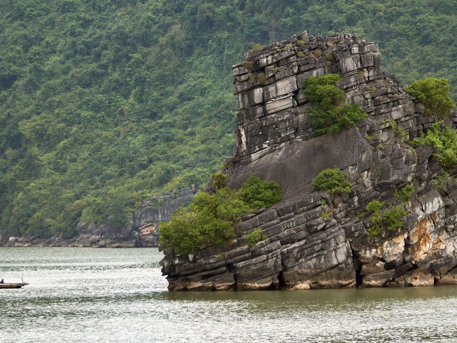
Đảo Ti TốpTi Tốp Island seen from the water, with its forested peak and the small pavilion on the summit.Photo: NKSTTSSHNVN, CC BY-SA 4.0
A monument to Gherman Titov stands at the bottom of the climb. Nearly 6 m tall and carved from more than 26 tonnes of green Thanh Hóa stone by the sculptor Lâm Quang Nới, it was unveiled on 14 September 2015 and stands by the piers in front of the ticket office, at the foot of the island.
Đảo Ti TốpThe stone statue of the cosmonaut Gherman Titov stands against a dark rock face on Ti Tốp Island, with his name and years carved on the plinth.Photo: Pamputt, CC BY-SA 4.0
Famous rocks seen from the boat
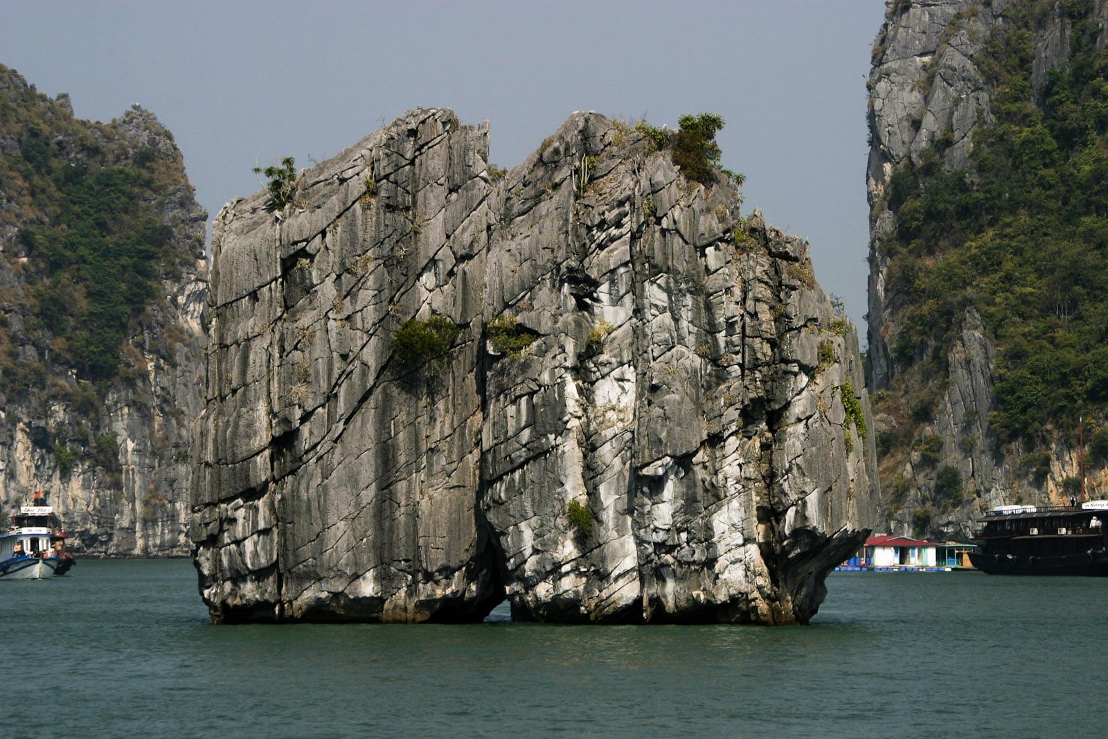
Boats on routes 1 and 5 pass Hòn Trống Mái (the Fighting Cocks), Hòn Đỉnh Hương (the Incense Burner), Hòn Chó Đá (the Stone Dog) and Hòn Muối Nam (the Finger Islet) without landing. Báo Quảng Ninh and VietNamNet identify the Ha Long Bay scene on the 200,000 VND polymer note as Hòn Đỉnh Hương, while the State Bank’s own description says only “Ha Long Bay landscape”.
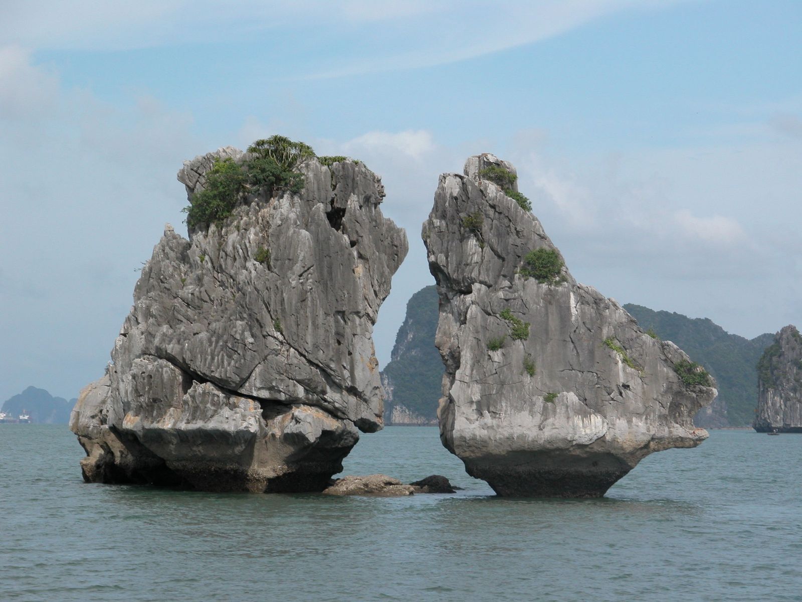
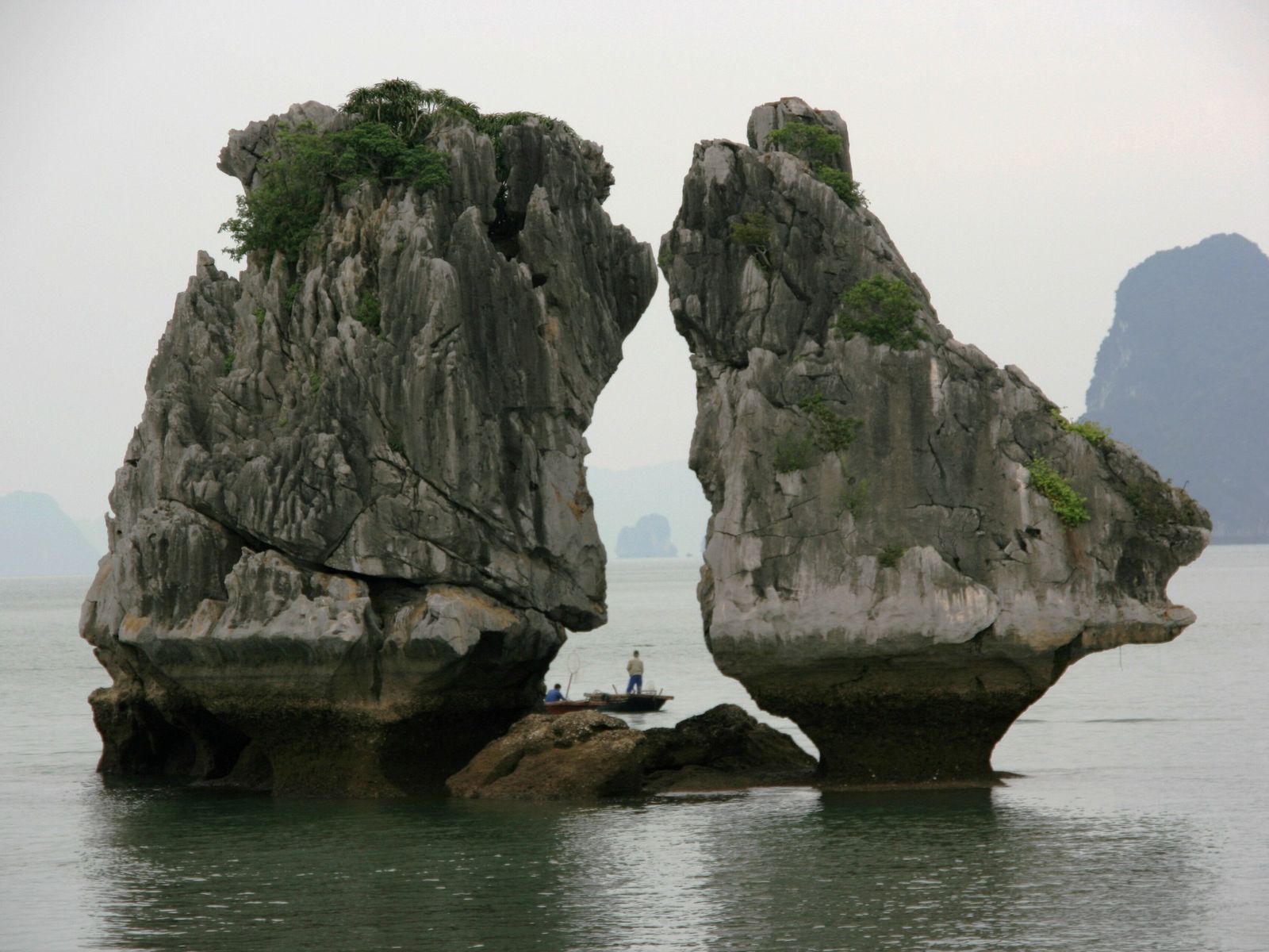
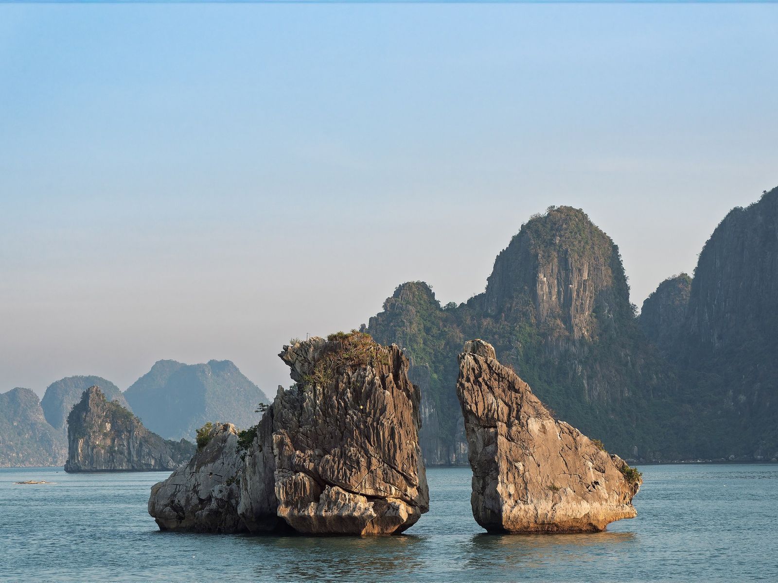
Hòn Trống Mái, also called Hòn Gà Chọi, is known in English as the Fighting Cocks, the Cock and Hen Islet or the Kissing Rocks. It is two small rock islets facing each other like a cock and a hen, and from another angle the pair reads as a giant fish. In the folk tale as the Board tells it, two celestial birds sent to wake the dragons that formed the bay lingered over the scenery and were turned to stone.
The pair is the symbol of Hạ Long tourism, and the Board says it was chosen in 2000 as a symbol of Vietnamese tourism. Its height depends on the source: about 12 m for the Board and VnExpress, 13.9 m in a geological survey of 2023, and over ten metres for the national tourism authority.
The rocks are fragile. A study approved in March 2022 found 40 unstable blocks, 11 on Trống and 29 on Mái, and erosion at the crest and the beak. Landing is not allowed, and in August 2023 boats were asked to keep 50 to 70 m away and slow to 10 km/h or less. Marker buoys were still being designed then, and the current arrangements have not been confirmed. Route 1, which passes the rocks, carried more than half of all bay visitors in 2023.
Hòn Trống MáiThe Kissing Rocks (Hòn Trống Mái) stand in warm evening light, with taller limestone peaks behind them.Photo: Mustang Joe, CC0
Hòn Đỉnh HươngHòn Đỉnh Hương (Incense Burner Islet), a cleft block of grey limestone, rises straight from the water in front of tall cliffs, with a small floating house and a boat at the right.Photo: Greg Willis from Denver, CO, usa, CC BY-SA 2.0
A broad rock on a narrow, sea-worn base in the Ba Hang area, south-west of Đầu Gỗ island, about 2.5 km from Tuần Châu. At low tide the eroded foot shows; at high tide the rock looks like an incense burner or a screen sheltering boats, and fishermen saw it as lucky. The Board lists Hòn Lư Hương as another name for the same islet. This is the rock that Báo Quảng Ninh and VietNamNet identify on the 200,000 VND note, in circulation since 30 August 2006.
Hòn Chó Đá(Stone Dog Islet)
VHL1VHL5
A dog-shaped rock about 8 m high at the water’s edge below a limestone peak, about 2.5 km from Tuần Châu. Fishermen regarded it as a guardian of the floating villages, and it is a named stop on routes 1 and 5.
Hòn Muối Nam(Finger Islet, also called Hòn Ngón Tay)
VHL1VHL5
A thumb-shaped pinnacle about 8 km from Tuần Châu and 9.2 km from Hạ Long port, and a photo stop on routes 1 and 5.
Hòn Xếp(Stacked-Rock Islet)
VHL4
An islet about 21 m high, built of stacked, almost rectangular limestone blocks, at the centre of a geological park on route 4. It lies about 30 km south-east of Tuần Châu and is also the end point of the Bái Tử Long routes BTL3 and BTL10.
Lists online also name Hòn Con Cóc (the Toad Islet) and Hòn Đầu Người (the Human Head Islet). Their only source is the Vietnamese Wikipedia, and no authoritative location, height or route has been found for either, so no boat can be expected to point them out.
Soi Sim Island
Đảo Soi Sim (Soi Sim Island) has a buoyed beach, wooden walkways and viewing platforms, but it has been closed to visitors since 2020 because its land, forest and sea-area allocation was never completed. A reopening was targeted for the end of June 2026, and none had been confirmed by 2 October 2026.
The island lies about 12 km from Tuần Châu port inside the strictly protected core zone. It takes its name from the sim shrubs (rose myrtle) whose ripe fruit fishermen came to pick, and purple flowers cover its slopes from about May to August. A conservation area was set up in 2011, an investor took over in 2016 and work stopped in 2019. Route 2 tickets kept listing the island while it was closed, and in 2026 it was named on the Corona Beach 100 list while still shut.
Tuan Chau Island
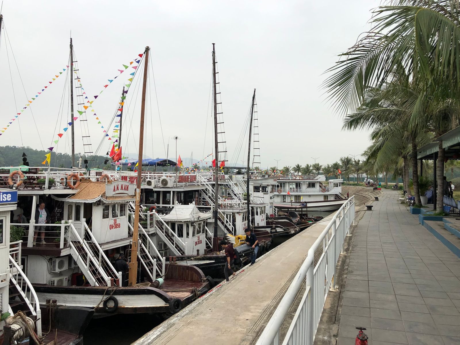
Đảo Tuần Châu (Tuan Chau Island) is a former island joined to the mainland by a road, and its Tuần Châu International Passenger Port is one of the two main departure points for every official route. The other is Hạ Long International Passenger Port on the Bãi Cháy waterfront. Development began in 1997, and the first road link, about 2 km long, was finished at the end of 1998.
The island has a dolphin show park, Harmony Hill and a King Kong park, and a car ferry runs from it to Gia Luận on Cát Bà with five fixed departures a day, taking about 50 minutes (April 2024 report). How to reach the port from the capital is on the Hanoi to Ha Long Bay page.
Đảo Tuần ChâuWooden tour boats with strings of bunting lie moored bow to stern along a quay lined with palm trees on Tuần Châu Island.Photo: Turgidson, CC BY-SA 4.0
Đảo Bồ Hòn (Bo Hon Island), about 3.8 km² in the centre of the bay, holds the caves of route 2: Hang Sửng Sốt, Hang Luồn and its lagoon, Hang Trống, Hang Trinh Nữ and Hồ Động Tiên. Several hundred rhesus macaques live in troops around Luồn. Đảo Đầu Gỗ (Dau Go Island), also called Canh Độc or Vạn Cảnh, rises to a 189 m peak at the western end of the core zone and holds Động Thiên Cung and Hang Đầu Gỗ, the caves of routes 1 and 5. See the caves side by side, with their routes, steps and crowds.
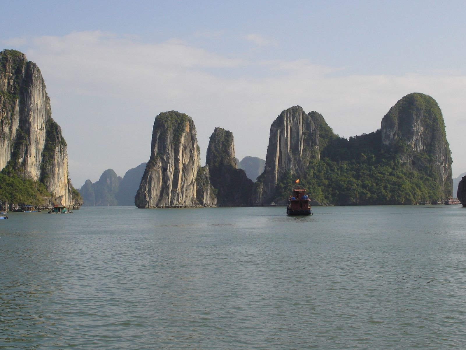
Vịnh Hạ LongTall limestone towers rise from calm water in Hạ Long Bay, with a wooden junk in front of them.Photo: Ondřej Žváček, CC BY 2.5
Other islands on the official routes
Route 4 reaches Đảo Cống Đỏ (Cong Do Island), an official overnight anchorage, and route 6 passes a string of islets on the way to the boundary with Lan Hạ Bay.
Đảo Cống Đỏ(Cong Do Island)
VHL4
About 23 km from Tuần Châu, with enclosed lakes such as Hồ Cá Bống, reached by a rock scramble and about 500 m of forest walking, and Hồ Cống Đỏ, reached through a cave at low tide. Cruise lines often sell it as Bái Tử Long, but officially it belongs to Ha Long Bay’s route 4, whose page lists sunrise and sunset viewing, squid fishing, yoga and tai chi among the activities on offer.
Hòn Chân Voi(Elephant's Foot Islet)
VHL6
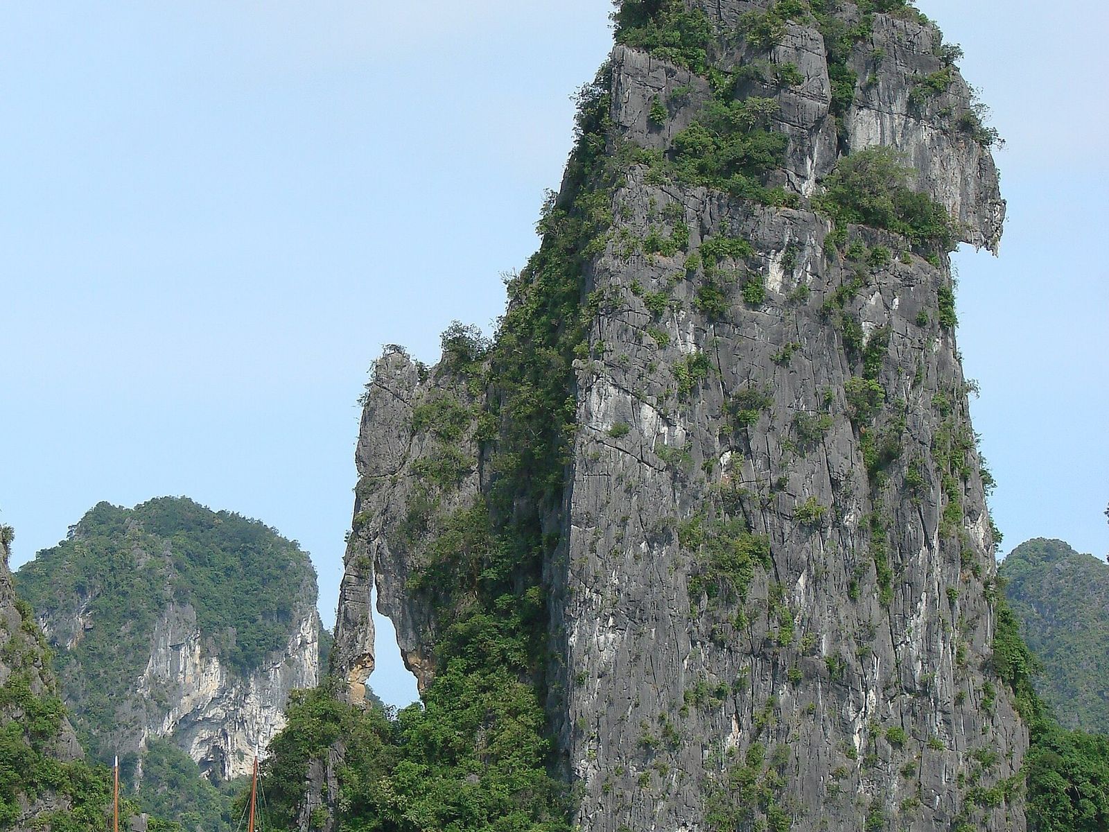
An islet with limestone legs reaching into the sea, 3.5 km from Tuần Châu, and the first sight on route 6. Close by is Vụng Ba Cửa (the Three-Gate Cove), a cove with three natural entrances and mangroves.
Đảo Tùng Lâm(Tung Lam Island)
VHL6
An island of linked limestone ridges about 5 km from Tuần Châu, home to the endemic Ha Long palm (cọ Hạ Long, Livistona halongensis).
Hòn Cặp Bài(Playing-Cards Islet)
VHL6
Two matching peaks like a pair of cards, 6 km from Tuần Châu, marking the boundary between Ha Long Bay and Lan Hạ Bay in Hải Phòng. Route 6 ends here, next to Gia Luận; it is for boats licensed to run between Hạ Long and Cát Bà, and its fee is 150,000 VND per person per day (checked October 2026).
Questions visitors ask
Is Ti Top Island worth the climb?
If you can manage a stairway of nearly 400 steps, yes: the pavilion about 100 m above the sea looks out over the whole bay, and the beach at the foot was the only licensed swimming beach operating in the bay in 2023. Expect company, as the island had about 2 million visits a year in 2022.
Can you swim at Ti Top?
The crescent beach on Ti Tốp was the only licensed, operating swimming beach in the whole bay in 2023. Swimming is mostly a summer activity, and no official season has been published.
Which rock is on the 200,000 VND banknote?
Báo Quảng Ninh and VietNamNet identify the scene as Hòn Đỉnh Hương, the Incense Burner. The State Bank’s own description says only “Ha Long Bay landscape”.
Can you land on the Fighting Cocks?
No. Landing at Hòn Trống Mái is not allowed, and in August 2023 boats were asked to keep 50 to 70 m away after a study found 40 unstable blocks on the two rocks.
Can you visit Soi Sim Island?
Not at present. Soi Sim has been closed to visitors since 2020, and no reopening had been confirmed by 2 October 2026.
Why do sites give different island counts?
They count different things. The Board’s 1,969 covers Ha Long Bay; 1,133 covers the World Heritage property, which since 2023 includes the Cát Bà archipelago; and “some 1,600” is older UNESCO wording.
Sources
Facts checked
Ha Long Bay - Yen Tu World Heritage Management Board, Vị trí địa lý (location and size of the bay), updated 6 November 2024.
Ha Long Bay - Yen Tu World Heritage Management Board, Natural conditions, updated 6 November 2024.
Ha Long Bay - Yen Tu World Heritage Management Board, Place pages for Ti Tốp, Trống Mái, Đỉnh Hương, Chó Đá, Muối Nam, Hòn Xếp, Soi Sim and Tùng Áng Cống Đỏ.
Ha Long Bay - Yen Tu World Heritage Management Board, Article on Đảo Ti Tốp, 2 August 2026.
Ha Long Bay - Yen Tu World Heritage Management Board, Hành trình VHL1, VHL2, VHL4 and VHL6 (route pages).
Ha Long Bay - Yen Tu World Heritage Management Board, Thời gian đón khách tham quan (visiting hours), updated 6 November 2024.
UNESCO World Heritage Centre, Ha Long Bay - Cat Ba Archipelago, list entry 672.
IUCN, World Heritage technical evaluations of Ha Long Bay (documents 154005 and 205800), 2000 and 2022.
Báo Quảng Ninh, Ti Tốp, hòn đảo ghi dấu tình hữu nghị Việt - Nga, 7 November 2017.
Báo Quảng Ninh, Article on Ti Tốp and Gherman Titov, 23 January 2022.
Báo Pháp luật, Report on the Titov monument on Ti Tốp, 13 September 2015.
Thanh Niên, Vì sao cả vịnh Hạ Long chỉ có một bãi tắm được cấp phép?, 8 May 2023.
Thanh Niên, Reports on Ti Tốp (12 July 2021) and its 24-hour medical post (2 April 2026).
VnExpress, Cẩm nang du lịch vịnh Hạ Long, updated 12 June 2026.
Tuổi Trẻ, Quảng Ninh tính cách giữ chân hòn Trống Mái, 18 August 2023.
Báo Quảng Ninh and VietNamNet, Reports identifying the scene on the 200,000 VND note, 26 July 2015 and 5 July 2021.
VietnamPlus, Tạm dừng đón khách tham quan tại bãi tắm Soi Sim trên Vịnh Hạ Long, 12 June 2026.
Thanh Niên, Bãi tắm top 100 thế giới trên vịnh Hạ Long đưa vào khai thác cuối tháng 6, 18 June 2026.
VnExpress, Report on Tuần Châu's attractions and the ferry to Cát Bà, 28 April 2024.
Prices, fees and timetables change. Figures on this page were checked in the month shown on the postmark.