Bai Tu Long Bay: the quieter bay next to Ha Long
Vịnh Bái Tử Long (Bai Tu Long Bay) lies north-east of Ha Long Bay, off Vân Đồn and Cẩm Phả. Its official boat routes opened in 2025, from Ao Tiên port.
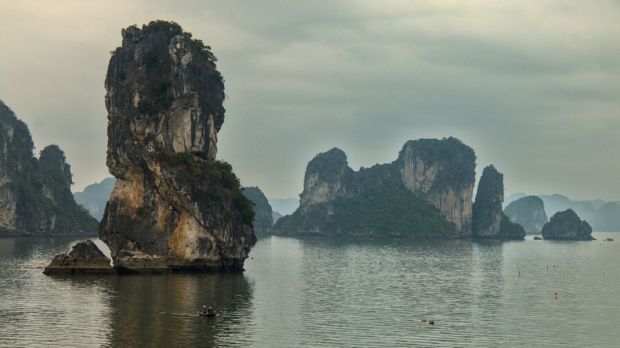
Where is Bai Tu Long Bay?
Bai Tu Long Bay lies north-east of Ha Long Bay in Quảng Ninh, off Vân Đồn (Van Don) and Cẩm Phả (Cam Pha). It is a separate national park, outside the World Heritage property, and no official area or island count exists for the whole bay.

The map shows the bay beside Ha Long Bay.
Is Bai Tu Long Bay better than Ha Long Bay?
It suits different travellers. The press describes Bai Tu Long Bay as little known to international visitors, with trips built around inhabited islands, villages and beaches, while Ha Long Bay has the large show caves and the better-established official routes.
In its favour
- It is little known to visitors, especially international ones, according to press reports from 2023 and 2024.
- Many islands are lived on, so trips centre on villages and beaches.
- A 2025 guide calls Quan Lan less crowded than Cô Tô or Ha Long Bay.
What to weigh
- “Quieter” rests on press descriptions, because nobody has counted visitors or boats on the bay. For scale, Ha Long Bay had about 10,000 visitors a day and about 500 registered boats in March 2026.
- The caves on its routes, Hang Nhà Trò and Hang Phất Cờ, have no published size; the large documented show caves (Sửng Sốt, Thiên Cung and Đầu Gỗ) are in Ha Long Bay.
- The official routes are new: published in July 2024, launched on 29 March 2025, and still missing from the Board’s visitor site, which lists only Ha Long’s VHL1 to VHL8. The park’s own site describes itself as in a test phase.
- Costs are unsettled while the sightseeing fee remains unpublished.
- After the road to Ao Tiên port comes a boat of 40 minutes to 1.5 hours to Quan Lan, so the islands want two or three spare days and are no day trip from Hạ Long.
The bays compared page sets Bai Tu Long beside Ha Long and Lan Ha, figure by figure.
What to see in Bai Tu Long Bay
The official routes visit Hang Nhà Trò and Hang Phất Cờ, pearl and village areas, and the beaches of Quan Lan and Minh Chau. Vung Viêng fishing village is on Ha Long’s route VHL4, and the connecting routes continue from there.
| Route | Boards at | Stops |
|---|---|---|
| BTL1 | Ao Tiên | Tây Hoi, Hòn Mèo May Mắn, Bản Sen and Nhà Trò cave |
| BTL2 | Ao Tiên | Phất Cờ cave, a pearl area at Hòn Đá Đen, Cống Lão Vọng, Hòn Đũa and Minh Chau |
| BTL3 | Ao Tiên | Hòn Xếp park |
| BTL4 | Ao Tiên | Cống Lão Vọng village, Trà Ngọ Lớn and Hòn Thiên Nga |
| BTL5 | Ao Tiên | Cái Đé and the Máng Hà anchorage |
| BTL6 | Ao Tiên | Trà Thần inlet, Cái Lim beach, Máng Hà and Cái Đé |
| BTL7 to BTL10 | Cam Pha (launch not confirmed) | Lương Ngọc beach, Vũng Đục, the Ông Cụ and Rều islands and Cửa Ông; BTL9 reaches Ngọc Vừng, Thắng Lợi, Quan Lan and Minh Chau |
| VHL-BTL1 to VHL-BTL3 | Continue from Ha Long route VHL4 | Thắng Lợi, Ngọc Vừng, Quan Lan and Minh Chau; Bản Sen and Nhà Trò; Hòn Đũa, Vũng Đục and Cửa Ông |
- Caves. Hang Nhà Trò, on BTL1 on the Bản Sen side about 2 km from the commune, has animal-shaped stalactites, and shells and fossils suggest people once lived there. Hang Phất Cờ is on BTL2, but no account of its size or features was found. In the park area Cái Đé is a tunnel cave on Cái Lim island that can be entered only at low tide, beside Hang Dơi; Hang Đông Trong lies about 500 m from the Van Don pier, and the Hang Quan system on Thắng Lợi was a wartime garrison.
- Quan Lan and Minh Chau beaches. Quan Lan island has two beach centres about 12 km apart. Minh Chau has gently sloping white sand and is calmer and quieter; the Quan Lan side is busier, though a 2025 guide calls its main bay beach calm and good for families. The 2026 guide names Quan Lan, Minh Chau, Việt Mỹ, Sơn Hào and Robinson beaches, and gives April to June as the best months, with storms and boat suspensions from July to September. Rooms on the two islands cost 300,000 to 3,500,000 VND a night, from homestays to resorts (March 2026).
- Village life and food. Sá sùng, the peanut worm, is dug from the tidal flats of Quan Lan and Minh Chau at low tide from February to October, mostly April to July, and only animals of 6 cm or more may be taken. Tu hài, the elephant-trunk clam, is farmed widely in the calm, plankton-rich water off Van Don. The Quan Lan communal-house festival runs from the 10th to the 20th day of the sixth lunar month, with the main day on the 18th.
-
Bãi biển Minh Châu, Vân Đồn People paddle and swim in the shallows of Minh Châu Beach in the late afternoon, with two wooded hills across the water.
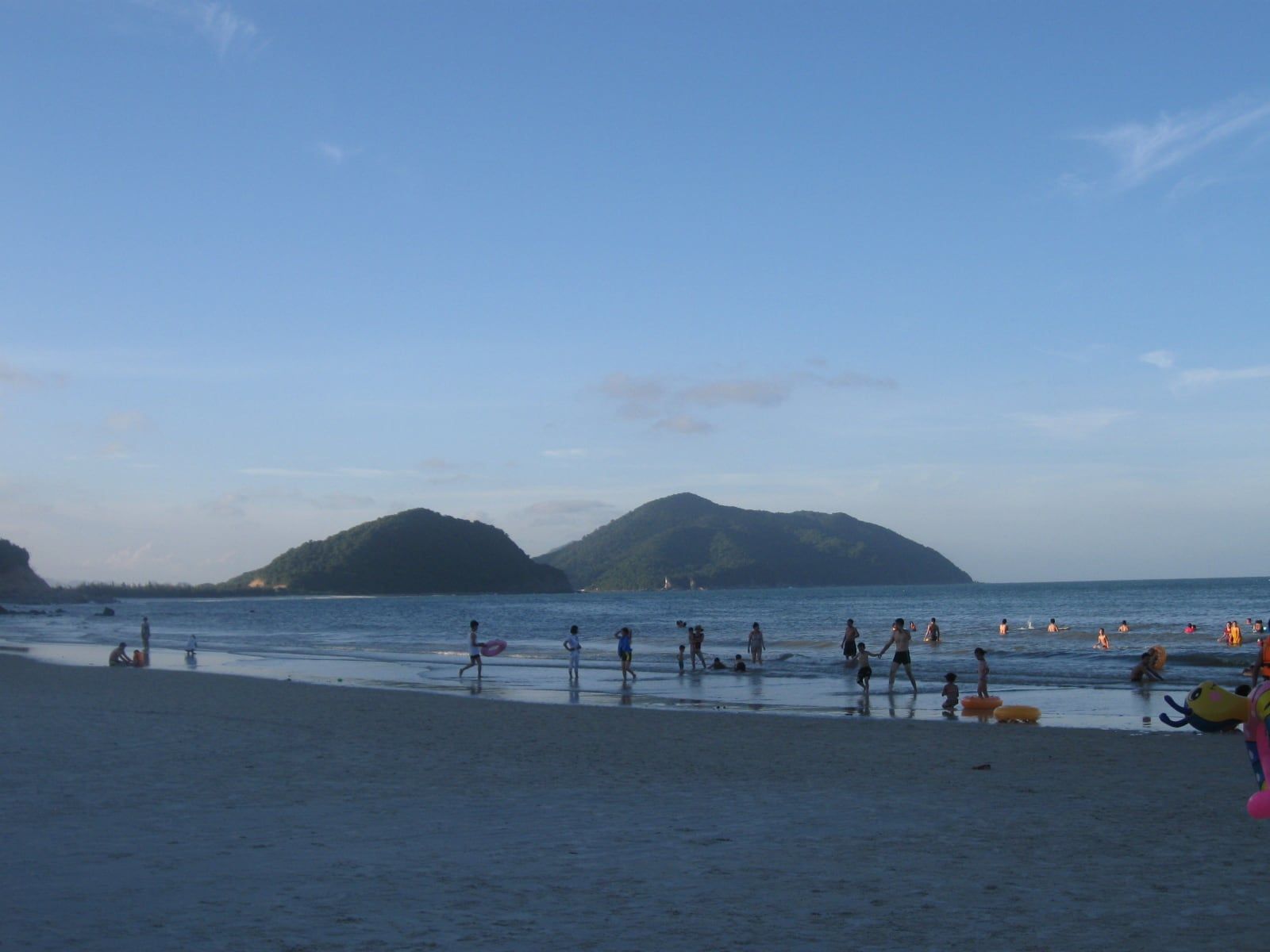
Bãi biển Minh Châu, Vân Đồn People paddle and swim in the shallows of Minh Châu Beach in the late afternoon, with two wooded hills across the water. Photo: Handyhuy, CC BY-SA 3.0 -
Bãi Sơn Hào, Vân Đồn Surf on the sand of Sơn Hào Beach on Cao Lôn Island, in Quan Lạn commune, Vân Đồn.
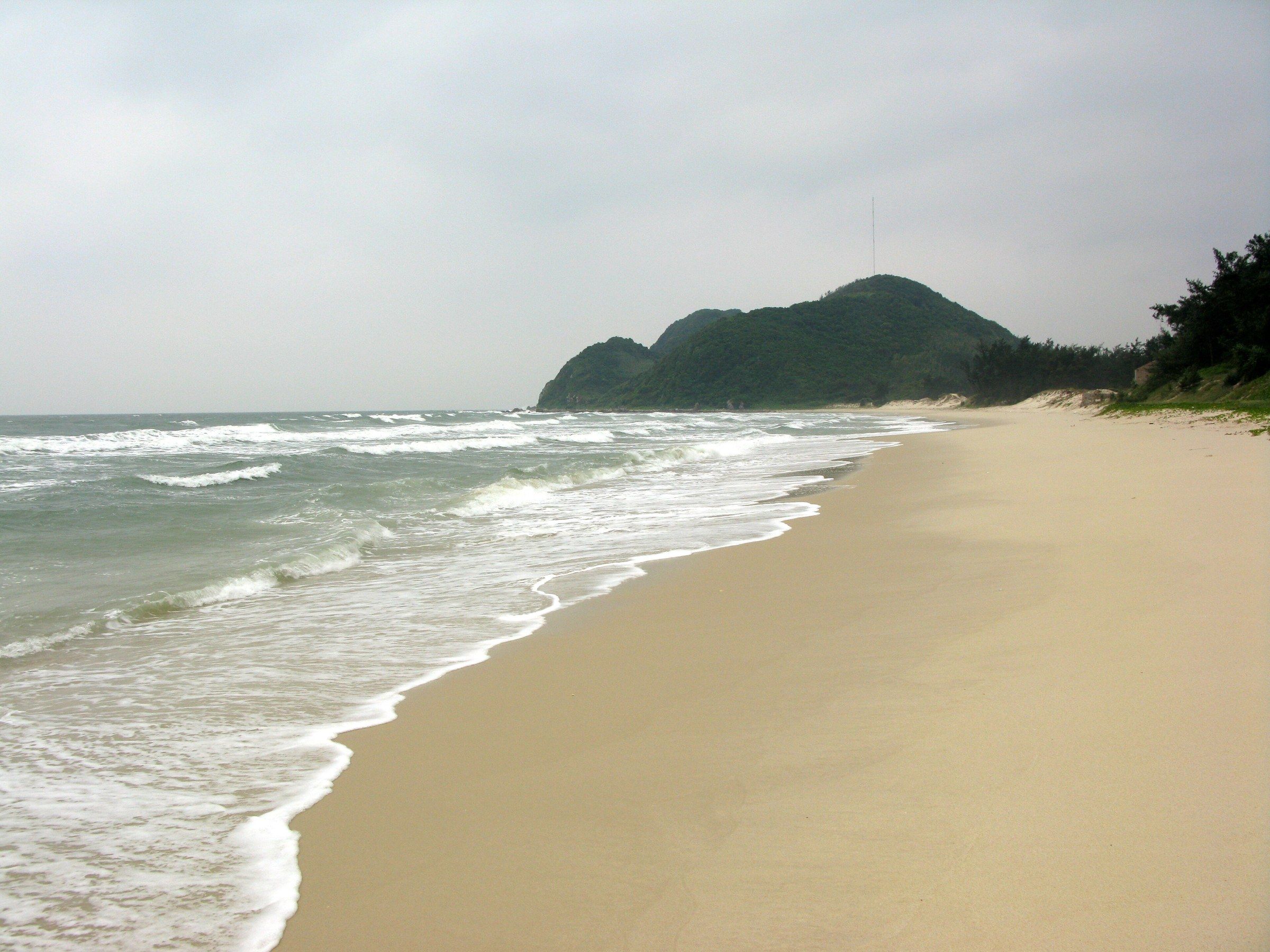
Bãi Sơn Hào, Vân Đồn Surf on the sand of Sơn Hào Beach on Cao Lôn Island, in Quan Lạn commune, Vân Đồn. Photo: Phó Nháy, Public domain -
Đảo Quan Lạn, Vân Đồn The communal house (đình) on Quan Lạn Island, with a tiled roof and an open yard.
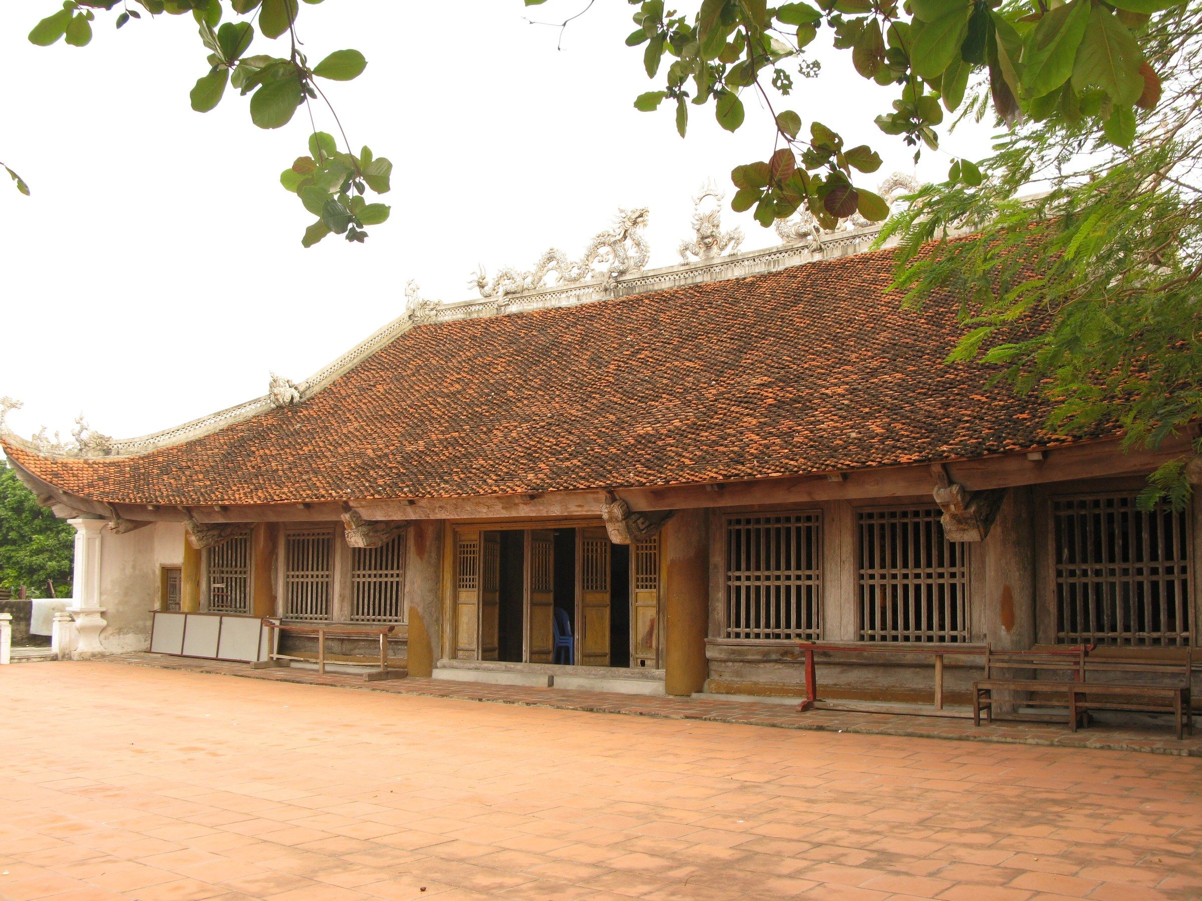
Đảo Quan Lạn, Vân Đồn The communal house (đình) on Quan Lạn Island, with a tiled roof and an open yard. Photo: Phó Nháy, Public domain -
Đảo Quan Lạn, Vân Đồn Red lacquered pillars and carved timber roof beams inside the Quan Lạn communal house.

Đảo Quan Lạn, Vân Đồn Red lacquered pillars and carved timber roof beams inside the Quan Lạn communal house. Photo: Phó Nháy, Public domain -
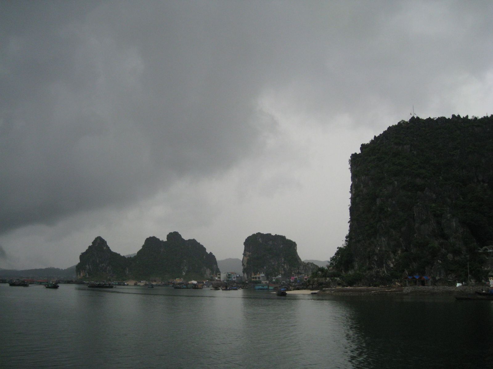
Vịnh Bái Tử Long Rowing boats of visitors approach a low limestone arch beneath a wooded cliff on green water in Bái Tử Long Bay.
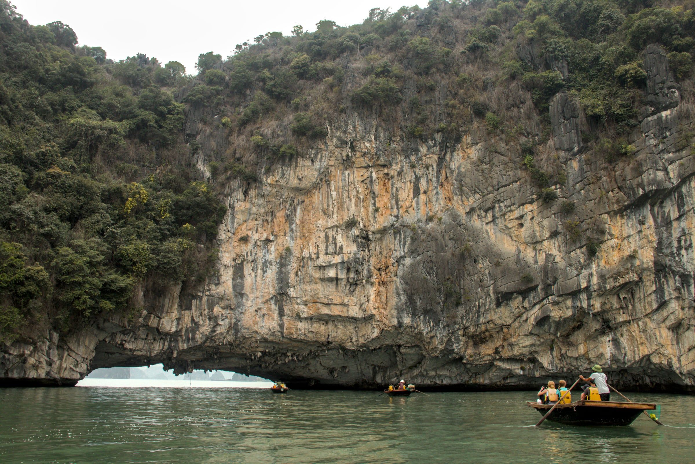
Vịnh Bái Tử Long Rowing boats of visitors approach a low limestone arch beneath a wooded cliff on green water in Bái Tử Long Bay. Photo: Benjamin Smith, CC BY-SA 4.0 -
Vịnh Bái Tử Long A small green fishing boat with three people aboard lies on calm green water below limestone cliffs in Bái Tử Long Bay.
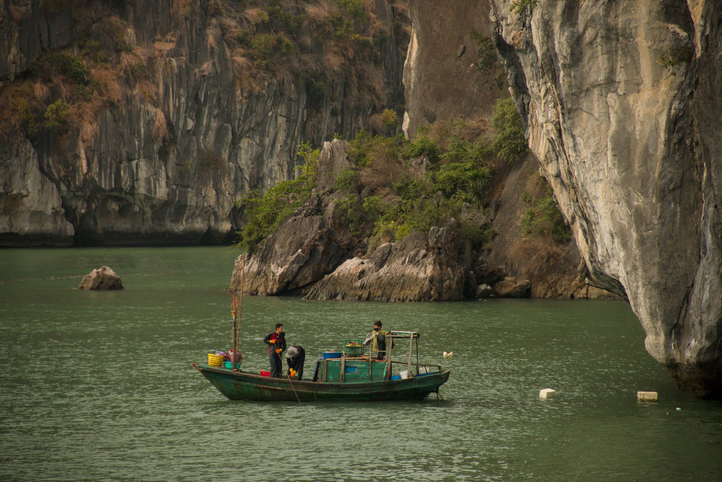
Vịnh Bái Tử Long A small green fishing boat with three people aboard lies on calm green water below limestone cliffs in Bái Tử Long Bay. Photo: Benjamin Smith, CC BY-SA 4.0
The islands are reached by boat. A bridge of over 967 m joining Minh Chau and Quan Lan with Bản Sen island, at about 550 billion VND, was still a plan at the end of 2025.
Bai Tu Long Bay cruises
Official Bai Tu Long day routes board at Ao Tiên port in Van Don (BTL1 to BTL6) and at Cam Pha (BTL7 to BTL10, launch not confirmed), and from Ha Long’s ports the way in is route VHL4 plus a connecting route, or an overnight cruise of three days and two nights. A fare band for Bai Tu Long cruising has not been published.
None of the official day itineraries starts at Hòn Gai, and no cruise that really boards there was found. Overnight cruises continue from Tuần Châu (Tuan Chau) through Ha Long Bay into Bai Tu Long: a “Heritage Journey of Ha Long” runs for three days and two nights, and a 109.9 m vessel with 55 cabins began a three-day Ha Long and Bai Tu Long programme from Tuan Chau in May 2024, without a published fare. A 46-cabin hybrid steel overnight boat is planned for the bay in 2027, and the Board repeated in September 2026 its target of steel hulls for all tour boats on Ha Long and Bai Tu Long bays by 2030, a plan that is not yet a rule.
Rules follow the Ha Long framework. In March 2026 Quảng Ninh ordered a review of the technical standards of every tour boat on both bays, with round-the-clock monitoring, and dining or parties in caves are not licensed. Storm suspensions reach this bay too: the 13 June 2025 notice set separate stop times for the Minh Chau to Cô Tô area, and the online thunderstorm warning system launched by July 2026 covers Ha Long and Bai Tu Long bays. The cruises page covers boat types, fees and safety.
How far is Bai Tu Long Bay from Hanoi?
Ao Tiên port, where the official routes that opened in 2025 board, is about 200 km from Hà Nội (Hanoi), mostly on expressway: about 3 hours by limousine (2025), a little less by car in good traffic. From there it is 40 minutes to 1.5 hours by boat to Quan Lan.
| Leg | Time or distance | Fare | Date |
|---|---|---|---|
| Limousine from Mỹ Đình or Giáp Bát bus station in Hanoi to Ao Tiên port | About 3 hours, about 200 km | 200,000 VND | 2025 |
| By car, mostly on expressway | Just over 2 hours in one press report | not published | 2025 |
| High-speed boat from Ao Tiên or Cái Rồng port to Quan Lan | 40 minutes to 1.5 hours (sources differ) | About 150,000 to 200,000 VND each way | 2024 to 2026 |
| Hạ Long to Van Don on the expressway | About 60 to 64 km | not published | opened 2019 |
Van Don International Airport lies about 20 km from Cam Pha and about 53 km by road from the Hạ Long International Passenger Port. It has few scheduled domestic flights and its routes have changed several times, so check current flights before planning around it (checked October 2026). The Hanoi to Ha Long Bay page compares the road and air options.

Questions visitors ask
Where is Bai Tu Long Bay?
Bai Tu Long Bay lies north-east of Ha Long Bay in Quảng Ninh, off Van Don and Cam Pha. It has hundreds of limestone and slate islands, including the inhabited Quan Lan and Minh Chau, and a national park of 15,783 hectares.
Is Bai Tu Long Bay better than Ha Long Bay?
It suits different travellers. The press describes Bai Tu Long Bay as little known to international visitors, with trips built around inhabited islands, villages and beaches, but its official routes only opened on 29 March 2025, its cave sizes are mostly undocumented and no sightseeing fee has been published.
How far is Bai Tu Long Bay from Hanoi?
Ao Tiên port, where the official routes opened in 2025 board, is about 200 km from Hanoi, about 3 hours by limousine (2025). From there the boat to Quan Lan takes 40 minutes to 1.5 hours.
Is Bai Tu Long Bay part of the World Heritage site?
No. The World Heritage property covers Ha Long Bay and the Cat Ba archipelago, Lan Ha Bay included. Bai Tu Long Bay is a separate national park, established in 2001, and an ASEAN Heritage Park, though the same Quảng Ninh board now manages it.
Why is Bai Tu Long Bay quieter?
The press gives several reasons: it is little known to international visitors, its official routes were published in July 2024 and launched on 29 March 2025, and many islands are inhabited, so trips centre on villages and beaches. The description rests on press accounts, since nobody publishes visitor or boat counts for the bay.
Where do Bai Tu Long Bay cruises leave from?
The official day routes board at Ao Tiên port in Van Don (BTL1 to BTL6), with BTL7 to BTL10 listed from Cam Pha, though their launch is not confirmed. From Ha Long’s ports the way in is route VHL4 plus a connecting route, or an overnight cruise of three days and two nights from Tuan Chau.
Is there an entrance fee for Bai Tu Long Bay?
No sightseeing fee is published. The routes were free of any sightseeing fee at launch in March 2025, until Quảng Ninh issues a ticket price, and visitors paid only the boat ticket and port charge. Check the current position with the operator or the Board.
Which is better, Lan Ha Bay or Bai Tu Long Bay?
They suit different trips. Lan Ha Bay is reached from Cat Ba Island and has small island beaches, with kayaking suspended since November 2024, while Bai Tu Long Bay is reached from Ao Tiên port and centres on Quan Lan’s beaches and villages. The bays compared page sets them side by side.
Sources
Facts checked- Ha Long Bay Management Board, Công bố các hành trình tham quan, du lịch trên vịnh Hạ Long, vịnh Bái Tử Long, 9 November 2024.
- Ha Long Bay Management Board, Giá trị Đa dạng sinh học (Biodiversity values), 2 November 2024.
- Ha Long Bay Management Board, Vị trí địa lý (Location), updated 6 November 2024.
- Ha Long Bay Management Board, Hành trình VHL4, read October 2026.
- Ha Long Bay Management Board, Tạm ngừng cấp phép đối với các phương tiện thủy hoạt động và lưu trú trên biển, 13 June 2025.
- Ha Long Bay - Yen Tu World Heritage Management Board, Tàu Hybrid mở hướng phát triển du lịch xanh trên vịnh Bái Tử Long, 20 September 2026.
- Báo Quảng Ninh, Thành lập Ban Quản lý Di sản thế giới vịnh Hạ Long - Yên Tử, 3 November 2025.
- Nhân Dân, Quảng Ninh khai trương các hành trình du lịch vịnh Bái Tử Long, 29 March 2025.
- VnExpress, 10 hành trình tham quan mới ở vịnh Bái Tử Long, 28 July 2024.
- VnExpress, Khám phá hang động trên vịnh Bái Tử Long, 12 July 2022.
- VnExpress, Miễn phí tour tham quan vịnh Bái Tử Long, 29 March 2025.
- VnExpress, 48 giờ ở Quan Lạn, 19 July 2024.
- VnExpress, 3 ngày 'trốn phố ra đảo' ở Quan Lạn, 29 June 2025.
- VnExpress, Cẩm nang du lịch đảo Quan Lạn 2026, updated 5 March 2026.
- VnExpress, Đi tìm 'vàng rong' trên đảo Quan Lạn, 9 August 2023.
- VnExpress, Giông sét trên vịnh Hạ Long được cảnh báo sớm trước 30 phút, 28 July 2026.
- VnExpress International, $20M cruise ship launches 3-day tour of Ha Long, Bai Tu Long bays, 26 May 2024.
- Tuổi Trẻ, Bái Tử Long, nơi chứa đựng những giá trị thiên nhiên phong phú, 6 March 2013.
- Tuổi Trẻ, Vườn quốc gia Bái Tử Long: Nguyên sơ và quyến rũ, 4 April 2008.
- Tuổi Trẻ, Đánh thức tiềm năng du lịch biển, Bái Tử Long thành điểm đến không thể bỏ qua, 24 March 2023.
- Tuổi Trẻ, Kết nối vịnh Hạ Long và Bái Tử Long, hút du lịch nghỉ dưỡng cao cấp, 26 May 2024.
- Tuổi Trẻ, Ăn chơi 'tẹt ga' ở đảo ngọc Quan Lạn với 2,5 triệu đồng, 17 May 2025.
- Tuổi Trẻ, Quảng Ninh siết chặt an toàn tham quan vịnh Hạ Long, 17 March 2026.
- Tuổi Trẻ, Quảng Ninh: Chưa cấp phép dịch vụ ăn uống trong hang động, 12 March 2025.
- Tuổi Trẻ, Quảng Ninh xây cầu kết nối các đảo ở hai đặc khu Cô Tô và Vân Đồn, 29 December 2025.
- Báo Quảng Ninh, Tu hài, đặc sản quý của vùng biển Vân Đồn, 6 September 2015.
- Vietnamese Wikipedia, Vịnh Bái Tử Long; Vườn quốc gia Bái Tử Long, read October 2026.
Prices, fees and timetables change. Figures on this page were checked in the month shown on the postmark.